 |
| Email us through your smartphone |
| |
|
| |
 |
Why We Need to Remove Marine Debris |
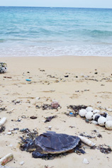
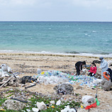
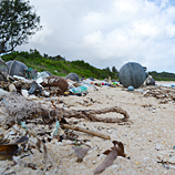
We need to clean the beaches periodically.
Whenever high tides come,
debris will flow back into the ocean
and harm marine creatures and ecosystems. |
 |
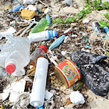
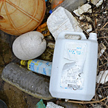
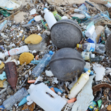
The following are groups of the most hazardous, high risk particles of marine debris. They are urgently in need of being removed from beaches before they return to the ocean by the next high tide.
|
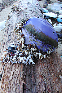
 Fishing Gears: Fishing Gears:
1. Fishing Nets
2. Fishing Lines
3. Fishing Floats and Quills
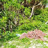
4. Fishing Gears such as Crab Pot and Traps
5. Ropes
6. PP Fish Box and Foam-filled Fish Box |
 |
| |
 Plastic Products: Plastic Products:
7. Pack Holders (for beverages)
8. Plastic Bags
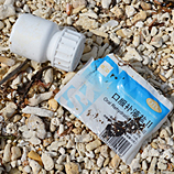
9. Caps, Lids, Pull Tabs
10. Plastic cups, plates, knives, forks, spoons
11. Food Wrappers and Containers
12. Straws, Stirrers
13. Beverage Bottles (plastic)
14. Balloons |
|
|
 Other Debris: Other Debris:
15. Cigarette Filters
16. Cigarette Lighters
17. Tires
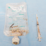
18. Syringes (Mostly to protect local children and swimmers)
19. Glass Beverage Bottles (Mostly to protect local children and swimmers from cuts and injuries)
20. Electric bulbs and fluorescent bulbs |
 |
   |
 |
Why We Can't Simply Clean the Ocean |
| 1. |
Since garbage flows and moves around in the ocean, it will take lots of time to locate specific areas of debris. A lot of money will be needed for this! |
| 2. |
Scooping up all the debris may sound simple, but it's not! Surprisingly, there are many sea creatures such as plankton, jellyfish, as well as fish and coral eggs that live among the floating debris. By scooping up the debris, that will mean that many sea creatures will be taken as well. This will harm the ecosystem. |
| |
| We cannot look at this situation lightly. The best thing that we can all do is to stop debris from flowing into the ocean. |
 |
How long will it take to dissolve these marine debris? |
| Paper Towel |
|
2-4 Weeks |
| Newspaper |
|
6 Weeks |
| Cotton Rope |
|
1-5 Months |
| Cotton Glove |
|
1-5 Months |
| Cardboard Box |
|
2 Months |
| Apple Cores |
|
2 Months |
| Waxed Milk Carton |
|
3 Months |
| Photo-Degradable Beverage Holder |
|
6 Months |
| Plywood |
|
1-3 Years |
| Wool Socks |
|
1-5 Years |
| Plastic Grocery Bag |
|
1-20 Years |
| Foamed Buoy |
|
50 Years |
| Foamed Plastic Cup |
|
50 Years |
| Tin Can |
|
50 Years |
| Aluminum Can |
|
200 Years |
| Plastic Beverage Holder |
|
400 Years |
| Disposable Diaper |
|
450 Years |
| Plastic Bottle |
|
450 Years |
| Monofilament Fishing Line |
|
600 Years |
| Glass Bottles and Jars |
|
Undetermined |
| |
|
|
| Data courtesy by NOAA and SeaGrant (Marine Debris from Land and Sea) |
 |
 |
Why We Research Debris at Miyako Island |
|
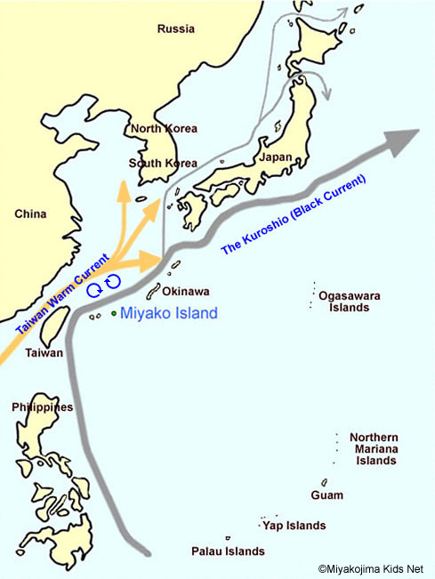 |
Miyako Island is geographically located by two ocean currents heading north. One of those currents is the Taiwan Warm Current in the East China Sea which travels north alongside mainland China. The other is the largest current in the world called the Kuroshio (Black current). It starts east of the Philippines and travels all the way up to the west coast of Canada and the United States. After 4.5 years, the current flows back to where it started.
Drifting debris of the southeast Asian region flows past Taiwan and gathers near the sea of the Ryukyu (Okinawa) basin, including Miyako Island. Miyako Island is one of the best places for the “Exit Survey Base at the Gateway” for Drifting Ocean Trash (Marine Debris). We research debris from the Southeast Asian region before they flow into the Pacific Ocean. The marine debris will travel to mainland Japan and flow to the west coast of Canada and the US after two years. |
| |
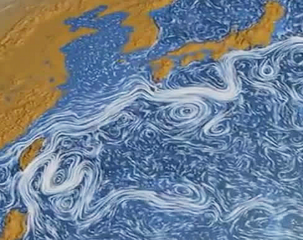
Photo courtesy: NASA - Perpetual Ocean |
 |
This image is a visualization of ocean current movements that was created by NASA's Scientific Visualization Studio based on data from June 2005 to December 2007.
This image shows two large currents merging north of Taiwan and branch currents (split flows) starting to circle around Miyako Island and other neighboring islands of Okinawa. As a result, lot of Southeast Asian marine debris washes ashore Miyako Island. |
| |
      |
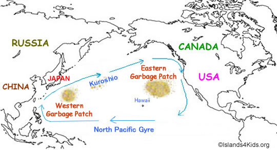
What are the “garbage patches”?
“Garbage patches” are concentrated areas of marine debris. These patches of marine debris do not form islands or other large formations that can be seen by satellite or aerial photographs. Though the specific locations cannot be specifically identified, there are two approximate areas of garbage patches. The “eastern garbage patch” is located approximately within the North Pacific Subtropical High between Hawaii and California. The “western garbage patch” may be located near the Kuroshio current off the coast of Japan. |
 |
| |
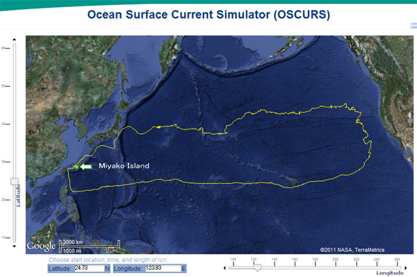 |
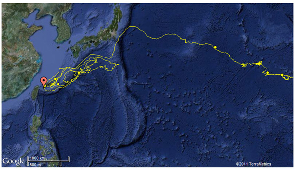
This photo is the result of our simulation using NOAA’s Ocean Surface Current Simulator to follow the movement of marine debris starting near Miyako Island.
|
| Marine Debris Movement Simulation: System Courtesy of NOAA |
| |
| To learn more about marine debris, please visit our international program, marine-debris.org. |
| |
|


