|

| Simulation System: Courtisy of NOAA |
The simulation results were prepeared by Miyakojima Kids Net |
| |
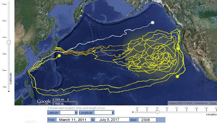
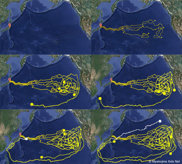
This animation was created by Miyakojima Kids Net to keep track of projected tsunami related debris drifting for past 6 years and 5 months (2308 days).
There are four different courses. Three beginning at major prefectures (Iwate, Miyagi, Fukushima) and one from the Fukushima nuclear power plant hit by the tsunami.
|

|
| To identify ocean currents were referred to NOAA’s OSCURS database. |
 |
Please check the latest arrival report on our principal research center website. |
 |
 |
This map and animation gives rough calculations based on the actual tidal current movement to know the whereabouts of dense areas of Japan Tsunami related marine debris.
The size and area of diffusion (yellow glow) may differ from actual diffusion due to the impact of other meteorological conditions. |
| |
 |
 |
What we are currently working on?: |
While we will continue with our research on the arrival survey of Asian originated marine debris, we are also closely following Japan tsunami related debris. We will collect statistical data to see which types of tsunami related debris will arrive first to the Pacific Northwest.
We are currently collecting information and preparing to receive instructions from scientific research organizations and government related research centers in order to establish a safe method for handling the tsunami debris, because tsunami related debris have the possibility of radioactive contamination from the Fukushima Nuclear Power Plant.(*6)
|
|


